


Carbon Storage Atlas
Lat/Long
The location of the overall study on terrestrial storage included the entire Southwest Regional Partnership on Carbon Sequestration (SWP) region. A small pilot study was done in the San Juan Basin, very near the site of the San Juan Basin enhanced coalbed methane (ECBM) project.
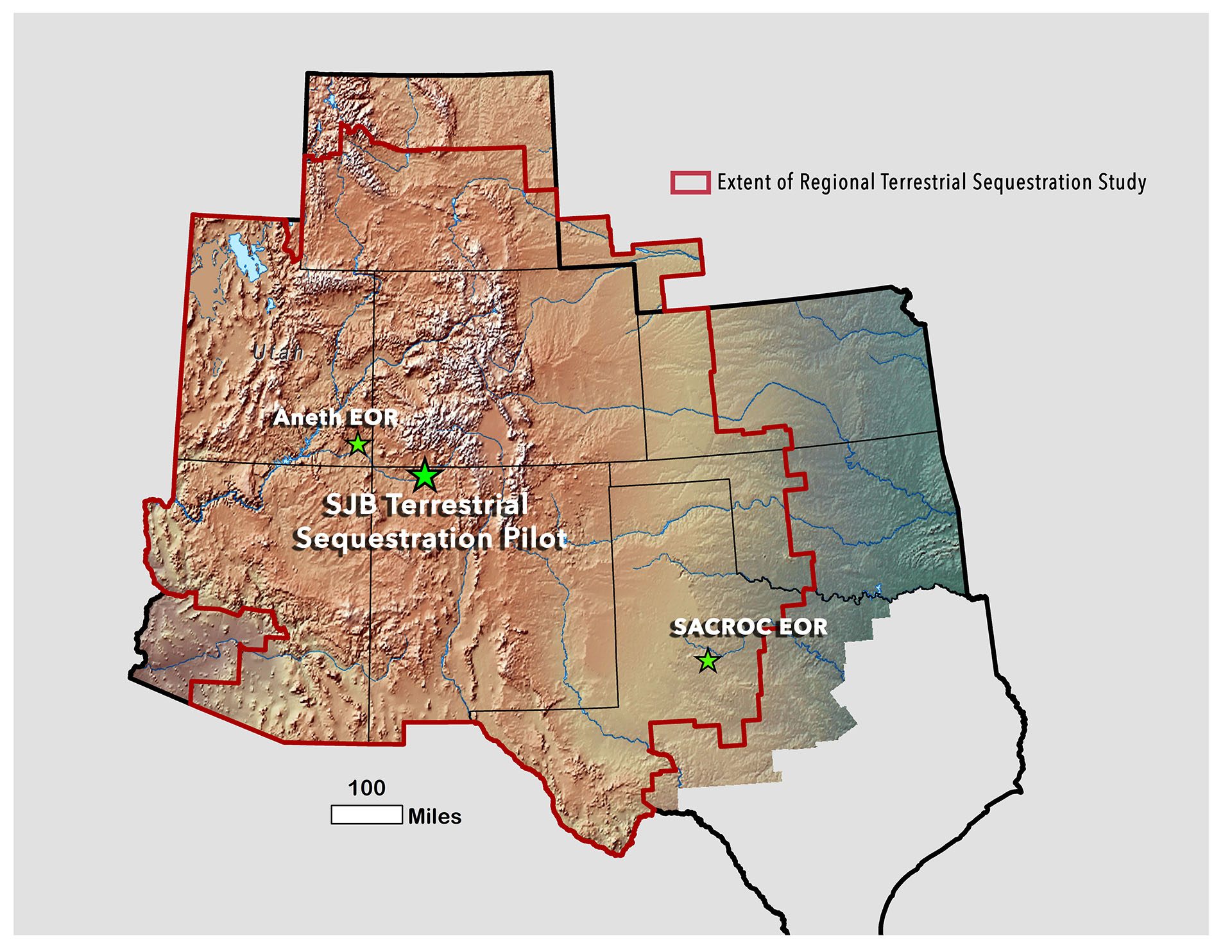
Location of the San Juan Basin terrestrial storage pilot study and generalized boundary (red line) of the regional-scale terrestrial storage study.
Why this Location
The Southwest Regional Partnership on Carbon Sequestration (SWP) wanted a full region assessment with respect to terrestrial storage. SWP hypothesized that local-scale changes cannot accommodate much additional carbon storage, and from analysis, this proves to be correct; thus, SWP focused on the entire region. The small-scale terrestrial location was chosen because SWP was able to leverage off pre-existing work being done by a variety of other agencies and organizations, including the local U.S. Bureau of Land Management (BLM) field office, New Mexico State University, and Los Alamos National Labs.
Main Research Q&As Discovered
The Southwest Regional Partnership on Carbon Sequestration’s (SWP) primary terrestrial storage goal was to assess terrestrial storage resource potential that may be achievable through systematic, regional adjustments to agriculture and other surface practices. The result and lesson learned was that only approximately 1 million metric ton storage capacity may be gained (increase) following specific changes to tillage practices; this comes with a caveat: storing carbon via addition of nutrients or water is reversed when inputs cease. Because of the water limitations in the region, terrestrial storage does not appear to be a viable storage mechanism of any significance in the Southwestern United States, and Phase III project design was subsequently focused on deep subsurface storage.
Lessons Learned
Lessons learned from this project did not affect Phase III design. By assessing terrestrial storage resource potential that may be achievable through systematic, regional adjustments to agriculture and other surface practices, the lesson learned was that only approximately 1 million metric ton storage capacity may be gained (increase) following specific changes to tillage practices; this comes with a caveat: storing carbon via addition of nutrients or water is reversed when inputs cease. Because of the water limitations in the region, terrestrial storage does not appear to be a viable storage mechanism of any significance in the Southwestern United States. Therefore, regardless of changes in tillage practices, only an insignificant amount of carbon could be stored. Phase III design was necessarily deep subsurface, unaffected by surface terrestrial storage practices.
Story of Interest
One useful outcome of the terrestrial storage process was in improvements of measurement of soil carbon. The Southwest Regional Partnership on Carbon Sequestration (SWP) developed improved technologies and systems for direct measurements of soil carbon. The team focused on two methods, including laser-induced breakdown spectroscopy (LIBS) and near infrared reflectance spectroscopy (NIRS). Both allow rapid scans of samples in the field. The team examined correlation of results with other technologies and examined principles for cost-effective sampling.