Business

Business
High-resolution 3D seismic BuoyLink rGPS deployed at an active injection site at Tomakomai Project in Japan (2018). Photo courtesy of Gulf Coast Carbon Center.
The United States (U.S.) Department of Energy (DOE) has completed studies to estimate the storage resource on the continental shelf off the Atlantic and Gulf coasts of the U.S. The projects used a variety of methodologies and covered different geologic settings offshore of the Gulf of Mexico (GOM) and the Atlantic coasts.
Currently DOE is funding two offshore partnerships to assemble the knowledge base required for secure, long-term, large-scale carbon dioxide (CO2) storage, with or without enhanced hydrocarbon recovery, and assess technology-development needs (infrastructure, operational, monitoring), which differ from those onshore.
The advantages of offshore CO2 storage for the U.S. include:
Considerations in determining the suitability of a formation for storage include:
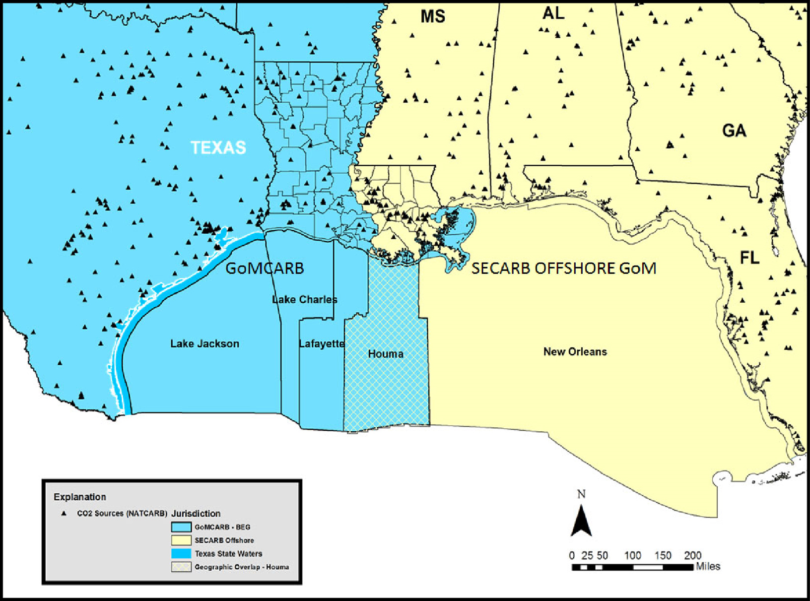
The Partnership for Offshore Carbon Storage Resources and Technology Development in the Gulf of Mexico (GoMCARB): The GoMCarb partnership compiles data and expertise in the region, integrating academic research institutions, government entities, and industry affiliates to address knowledge gaps, regulatory issues, infrastructure requirements, and geologic and engineering technical challenges of storing CO2.
Southeast Regional Carbon Storage Partnership: Offshore Gulf of Mexico (SECARB GOM): SECARB GOM is leading a coalition of southern universities and technical experts to expand the existing GOM government-industry partnership and focus on assembling the knowledge base required for secure, long-term, large-scale CO2 subsea storage.
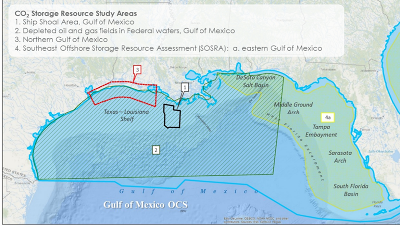
Sediments beneath the GOM represent a vast storage resource in oil and gas reservoirs and saline formations, and resource estimates benefit from extensive oil and gas exploration and development data. Using production data, it is estimated that there are 20 billion metric tons of storage in just the oil and gas reservoirs. Including saline formations, analysis of seismic data and well data indicates that hundreds of billions of metric tons, or more, storage resource is available in the Gulf.
Detailed discussion of the results of these studies are provided by Savage and Ozgen and Agartan et al., Bruno et al., Nemeth et al. and https://www.beg.utexas.edu/gccc/research/osra.
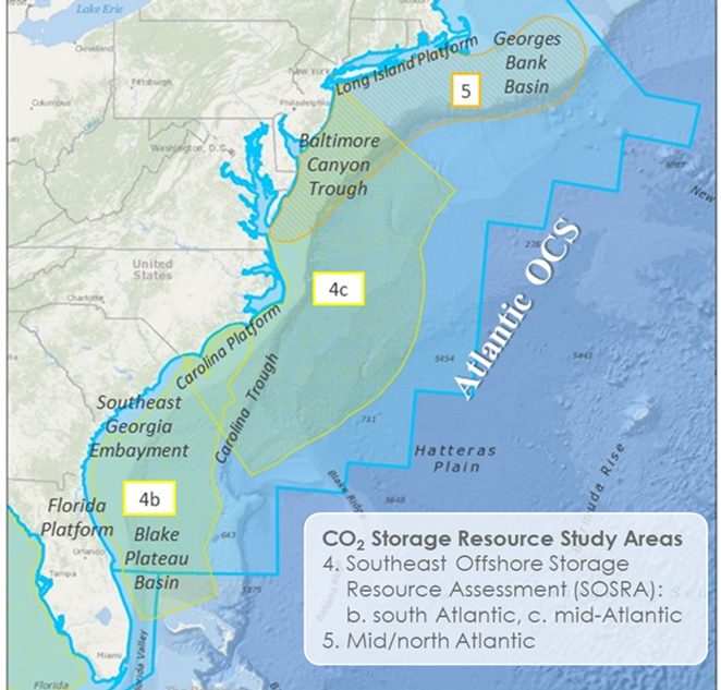
Storage resource estimates are less well-defined off the Atlantic coast due to lack of data. Nonetheless, improved stratigraphic models, guided by biostratigraphy and combined with available seism ic data, indicate hundreds of billions of metric tons, or more, of storage resource is also available throughout a large study area from New York to northern Florida.
Detailed discussion of the results of these studies are provided by Gupta, Nemeth et al.
| Offshore Partnership Project Landing Pages | |
|---|---|
| Southeast Regional Carbon Storage Partnership: Offshore Gulf of Mexico | Southern States Energy Board (SSEB) |
| FE0031557 | |
| Offshore Gulf of Mexico Partnership for Carbon Storage - Resources and Technology Development (GOMCarb) | University of Texas at Austin |
| FE0031558 | |
| Assessment of CO2 Storage Resources in Depleted Oil and Gas Fields in the Ship Shoal Area, Gulf of Mexico | Geomechanics Technologies, Inc. |
| FE0026041 | |
| Offshore CO2 Storage Resource Assessment of the Northern Gulf of Mexico | University of Texas at Austin |
| FE0026083 | |
| Southeast Offshore Storage Resource Assessment | Southern States Energy Board (SSEB) |
| FE0026086 | |
| Mid-Atlantic U.S. Offshore Carbon Storage Resource Assessment Project | Battelle Memorial Institute |
| FE0026087 | |
| Offshore Storage Resource Assessment | NITEC, LLC |
| FE0026392 | |