Business

Business
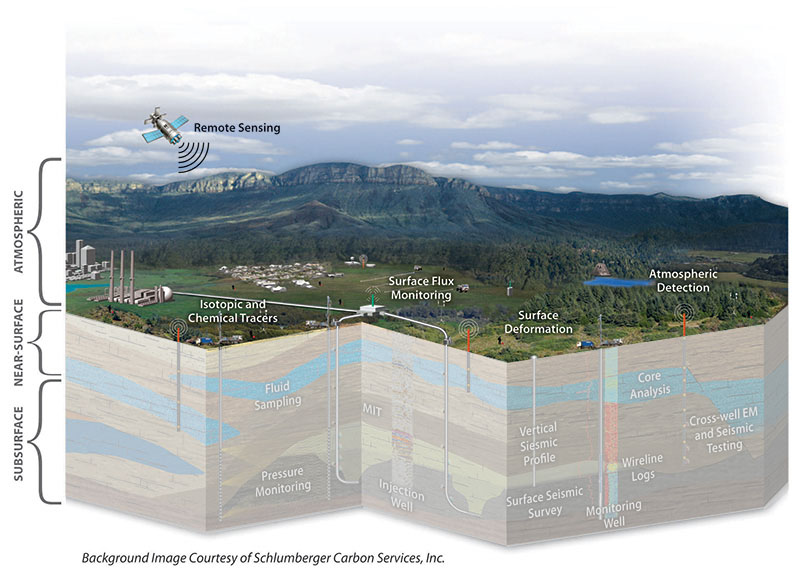
The Atmospheric Monitoring key technology comprises technologies to monitor and quantify CO2 in the atmosphere, often in low concentrations. A number of tools and techniques have been developed specifically for geologic storage sites to assure that CO2 from those sites is not released to the atmosphere through leakage pathways, which could be associated with wellbores, faults, or fractures.
Description
The three most common atmospheric monitoring techniques are (1) the use of optical CO2 sensors, (2) tracking of atmospheric tracers, and (3) eddy covariance (EC) flux measurement techniques. All three techniques have distinct advantages and limitations. Optical sensors can provide continuous or intermittent measurement of CO2 in a localized area, but they are not well-suited to monitoring over large areas. In addition, they are not able to differentiate between CO2 released from storage and natural variations in ambient CO2. Atmospheric tracers, while useful as a proxy for CO2, may require the use of analytical equipment that is not typically available at CO2 storage sites. The EC technique has the potential to be a powerful tool, because it can provide a time-averaged and spatially averaged data set over a large area. However, data processing is highly complex.
Research Agenda and Challenges
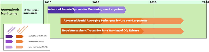
Tools are needed to identify and quantify possible releases of CO2 to the atmosphere from underground storage reservoirs. Such monitoring is critical to the success of future CO2 storage projects and provides assurance that CO2 is remaining in the subsurface. A reliable aboveground monitoring system needs to be in place to detect elevated levels of atmospheric CO2 that could potentially have been released from wellbores, faults, or other conduits. It is also important to be able to detect high concentrations of CO2 in low-lying areas and in manmade structures.
Pathways for atmospheric monitoring research include:
NETL-Supported Atmospheric Research
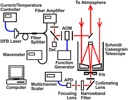
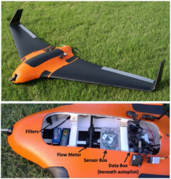
NETL supports projects that are addressing research challenges associated with Atmospheric Monitoring. Examples of projects supporting this key technology include (1) development of an integrated monitoring system that is capable of directly detecting and quantifying seepage of CO2 and CH4 into the soil and atmosphere by means of in-ground and surface sensors and unmanned aerial vehicles (UAV) to collect data; (2) development and field testing of geochemical-based (isotope and perfluorocarbon tracers) technology to monitor and assess CO2 injection operations and, in particular, to detect CO2 leakage from the reservoir by observing tracers in the atmosphere; and (3) developing dual prototype optical scanning sensors and coupling them with a series of retro-reflecting mirrors to produce a networked system that will make high quality CO2 path measurements over an open area of up to several km2.
The MVA webpage offers links to detailed information on projects performing research in this area.