Business

Business
Increase production and reserves from the shallow shelf carbonate reservoirs in the Ismay and Desert Creek zones of the Pennsylvania age Paradox Formation, in the Paradox Basin of Utah and Colorado. The project proposed using horizontal laterals from existing vertical field development wells to optimize production.
Utah Geological Survey
Salt Lake City, UT
Eby Petrography & Consulting
Salt Lake City, UT
Colorado Geological Survey
Denver, CO
Seeley Oil Company
Most of the Pennsylvania Paradox Formation fields are characterized by high initial production rates followed by a very short production life (primary). Only 15 to 25% of the original oil-in-place (OOIP) is recoverable during primary production with conventional vertical wells. The previous DOE Class II study of the Paradox Basin demonstrated that secondary recovery by waterflood is not as effective as carbon dioxide flooding.
The small Ismay and Desert Creek fields are at risk of premature abandonment. At least 200 million barrels of oil is at risk of being left behind in them because of inefficient development practices that leave undrained these very heterogeneous reservoirs. Because of the widespread nature of the carbonate mound fields, the Desert Creek and Ismay zones have not been adequately characterized. Small, independent operators of single fields do not have the time, money, or expertise to perform this analysis. The Utah Geological Survey serves the public by conducting regional studies which small companies cannot under take by themselves.
The proposal suggested a three-phase, multi-disciplinary approach to increase production and reserves from the shallow-shelf carbonate reservoirs in the Ismay and Desert Creek zones of the Paradox Formation using horizontal laterals from existing vertical field development wells: 1) conduct detailed geologic analysis of fields, 2) drill horizontal wells from existing vertical wells to test hypothesis developed in Phase 1, and 3) extended monitoring to determine impact of Phases 1 and 2.
Project Results
Two San Juan County, Utah fields were evaluated for horizontal drilling potential: Cherokee and Bug, producing from the Ismay and Desert Creek zones of the Paradox Formation, respectively. Three-dimensional (3-D) thickness models indicate five porosity units have an untested northeastern area in the Cherokee case-study field, San Juan County, Utah. Based on Cherokee reserve calculations, the remaining recoverable oil and gas reserves are nearly 168,000 BO and 3 BCFG, suggesting the presence of additional undrained zones. For the Bug case-study field, the volume calculated for net feet of porosity greater than 10 percent is 99,057 acre-feet, as derived from 3-D models. This also suggests the presence of additional undrained zones. The lower Desert Creek may contain recoverable oil and gas reserves of nearly 2,440,000 BO and 5.7 BCFG. It was recommended by the UGS that horizontal drilling techniques be used to tap undrained reservoirs as a demonstration in these fields.
Benefits
Detailed reservoir characterization and analysis of horizontal wells by the Utah and Colorado Geological Surveys will provide information and assessment of horizontal drilling of prospects in the Blanding Sub-basin of the Paradox Basin that small, independent operators could not afford on their own. Work by the geological surveys will not be restricted to individual leases or time constraints and can thus provide a more comprehensive and objective analysis available to all companies working in the area. Methodologies to identify drilling prospects in the over 100 small carbonate mound fields in the Paradox Basin holds the key to recovery of an estimated 200 million barrels of oil.
Project Summary:
(July 2007)
Budget Period I began April 6, 2000 and ended June 30, 2006. There have been seven no-cost extensions, mainly to allow time to find a new industry partner willing to participate in the field demonstration (Budget Period II). Although the study found horizontal drilling would in economically increasing production and reserves extending of the Bug and Cherokee case-study fields, the operators (industry partners) decided not to participate in the field demonstration. The primary reasons for these decisions were drilling commitments for gas plays elsewhere, the unavailability of rigs, drilling costs way above those at the time the project was proposed, and limited overall budgets of the small operators of the fields. The project team has made presentations to numerous potential industry partners, issued press releases inviting horizontal drilling proposals from operators of fields similar to the case-study fields, and displayed project objectives and goals at various AAPG meetings. A partner was never found for the field demonstration phase of the project. The UGS and DOE have decided to end the project, and publish all project results and recommendations in a Final Report at the end of June 2006.
$227,717
$131,137 (37% of total)
Other Government Organizations Involved: Geologic Surveys of Colorado and Utah
NETL - Virginia Weyland (virginia.weyland@netl.doe.gov or 918-699-2041)
Utah Geological Survey - Thomas Chidsey (tomchidsey@utah.gov or 801-537-3364)
Publications
Eby, D.E., and Chidsey, T.C., Jr., 2001, Heterogeneous carbonate buildups in the Blanding sub-basin of the Paradox Basin, Utah and Colorado - targets for increased oil production using horizontal drilling techniques [abs.]: American Association of Petroleum Geologists Annual Convention, Official Program with Abstracts, v. 10, p. A55.
Chidsey, T.C., Jr., 2002, Carbonate buildups in the Paradox Basin, targeted for horizontal drilling: U.S. Department of Energy, The Class Act, v. 8, no. 1, p. 3-6.
Chidsey, T.C., and Eby, D.E., Jr., 2002, Reservoir diagenesis and porosity development in the upper Ismay zone, Pennsylvanian Paradox Formation, Cherokee field, southeastern Utah [abs.]: American Association of Petroleum Geologists Rocky Mountain Section Meeting Official Program Book, p. 20-21.
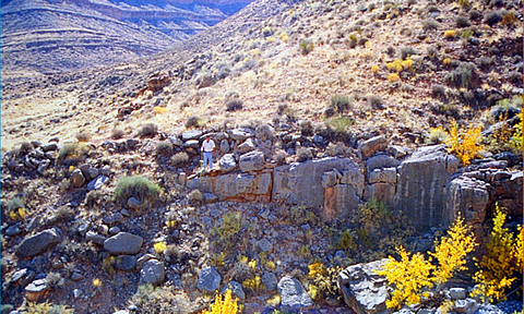
Chidsey, T.C., Jr., 2003, An up close and personal view of Cherokee oil field, San Juan County, Utah: Utah Geological Survey, Survey Notes, v. 35, no. 2, p. 1-3.
Eby, D.E., Chidsey, T.C., Jr., Morgan, C.D., and McClure, K., 2003, Regional facies trends in the upper Ismay zone of the Blanding sub-basin of the Paradox Basin, Utah – aids for identifying possible targets for horizontal drilling [abs.]: American Association of Petroleum Geologists Annual Convention, Official Program with Abstracts, v. 12, p. A48.
Chidsey, T.C., Jr., Morgan, C.D., and McClure, K., 2004, Outcrop analogs in Utah – templates for reservoir modeling [abs.]: American Association of Petroleum Geologists Annual Convention, Official Program with Abstracts, v. 13, p. A24.
10 Semi-Annual Technical Progress Reports U.S. Department of Energy, DOE/BC15128-1-10.