
Business

Business
This project will develop an integrated resource assessment model of the Trenton-Black River reservoirs in New York, Ohio and West Virginia. This effort will increase development of the gas resources from the Trenton-Black River reservoirs and facilitate increased exploration and higher success rates in this emerging play.
This project has three main objectives:
The final product of this project will be a detailed and multi-disciplinary play book.
West Virginia University Research Corporation
Location:
Morgantown, West Virginia 26505
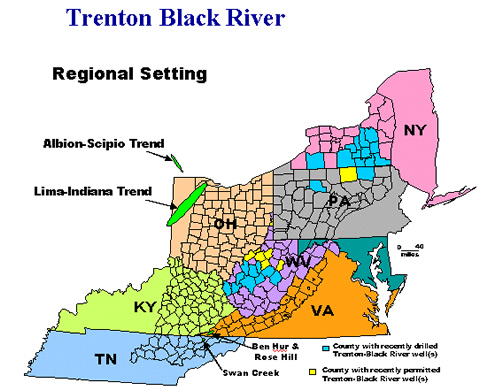
Exploration interest has renewed in the Ordovician Trenton and Black River carbonates following recent exploration success in several Appalachian locations. Speculation among geologists in the basin is that many additional producing reservoirs of this type may be found along dolomitized fracture and fault zones throughout the basin. A basinwide collaborative effort to understand the play and delineate potential trends is seen as an opportunity to accelerate and optimize the development of this natural gas resource.
The effort will include structural and seismic investigations; stratigraphic analysis; petrographic analysis; isotope geochemistry and fluid inclusion analysis; petroleum geochemistry; analysis of production data and horizontal drilling results, and development of a web-based GIS database. This effort will be implemented through the creation of a new consortium consisting of companies active in the play that will commit cost share funds and data to the project, the New York State Museum and four state geological surveys (Kentucky, Ohio, Pennsylvania, West Virginia) who are members of the Appalachian Oil and Natural Gas Research Consortium (AONGRC).
The play book developed by the consortium will include an integrated structural-diagenetic-stratigraphic model for the origin of the Trenton-Black River hydrothermal dolomite reservoirs. This model will be employed with structural and tectonic analyses to identify possible fairways and target areas that are favorable for the creation of productive pools. Companies utilizing this book will be able to concentrate their future geophysical and geochemical programs in these preferred areas, thus increasing their chances of economic success.
Results:
Private- and public-sector stakeholders formed the new “Trenton-Black River Appalachian Basin Exploration Consortium.” The final membership of the Consortium includes 17 gas exploration companies and 6 research team members, including the state geological surveys in Kentucky, Ohio, Pennsylvania and West Virginia, the New York State Museum Institute and West Virginia University. Seven integrated research tasks are being conducted by basin-wide research teams organized from this large pool of experienced professionals.
Researchers have begun mining existing databases to determine areas of data strengths and weaknesses. Geologists from each of the states cooperated in this effort so that consistency of stratigraphic nomenclature and log data among the states can be established. The process of scanning well logs using a Neuralog scanner has begun and logs have been digitized using DigiRule hardware and software. Geologists in Pennsylvania and Kentucky conducted field work to describe and sample Trenton-Black River outcrops. Thin sections made from outcrop and core samples have been examined, described and compared. Hardware to be used to collect gas samples from Trenton-Black River wells has been assembled, and wells selected for sampling purposes.
More than 3400 miles of Appalachian basin digital seismic data have been quality checked. In addition, inquiries have been made regarding the availability of additional seismic data from government and industry partners in the consortium. Interpretations of the seismic data have begun. Error checking is being performed by mapping the time to various prominent reflecting horizons, and analyzing for any anomalies. A regional geological velocity model is being created to make time-to-depth conversions.
Members of the stratigraphy task team compiled a generalized, basin-wide correlation chart, began the process of scanning geophysical logs and laid out lines for 16 regional cross sections. Two preliminary cross sections were constructed, a database of all available Trenton-Black River cores was created, and a basin-wide map showing these core locations was produced. Two cores were examined, described and photographed in detail, and were correlated to the network of geophysical logs.
Members of the petrology team have begun the process of determining the original distribution of porous and permeable facies within a sequence stratigraphic framework. A detailed sedimentologic and petrographic study of the Union Furnace road cut in central Pennsylvania was completed. This effort will facilitate the calibration of subsurface core and log data. A core-sampling plan was developed cooperatively with members of the isotope geochemistry and fluid inclusion task team.
One hundred thirty (130) samples were prepared for trace element and stable isotope analysis, and six samples were submitted for strontium isotope analysis. It was learned that there is a good possibility that carbon isotope stratigraphy may be a useful tool to locate the top of the Black River Formation in state-to-state correlations.
Gas samples were collected from wells in Kentucky, New York and West Virginia. These were sent to a laboratory for compositional, stable isotope and hydrogen and radiogenic helium isotope analysis.
Decisions concerning necessary project hardware, software and configuration of the website and database were made by the data, GIS and website task team. A file transfer protocol server was established for project use. The project website is being upgraded in terms of security.
The working group has met and final edits to all of the products have been agreed on for the final copy. A meeting was held with USGS personnel to discuss the gas in place estimates for the formations identified in the atlas. It is expected the product will be delivered before the March 30 scheduled date.
and Remaining Tasks:
A Consortium Agreement has been sent to the five research partners and each of the industry partners who are providing cost share. The project has been completed and a final report [PDF-112.01MB] is available.
Work has been completed on all of the eight integrated task areas:
$1,012,454
$635,355
NETL – Thomas H. Mroz (Thomas.Mroz@netl.doe.gov or 304-285-4071)
West Virginia University Research Corporation – Douglas Patchen (304-293-2867 or dpatch@wvunrcce.nrcce.wvu)
Final Project Report [PDF-112.01MB].
Trenton Black River Data Shapefiles and Spreadsheets [external site - West Virginia Geological Survey]
Technical Assessment [PDF-14KB]
Appalachian Oil and Natural Gas Research Consortium (AONGRC) website

