
Business

Business
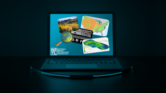
NETL researchers have harnessed the power of artificial intelligence (AI) to develop a tool that can ingest enormous amounts of unstructured geological data such as publications, maps, websites and presentations and then accurately label the visual data — work that could lead to a better understanding of the subsurface for safer energy production and carbon dioxide storage.
“Dozens of researchers working around the clock could never process as much data as this tool can output in under 10 minutes,” said NETL’s MacKenzie Mark-Moser. “AI shines in its capacity to perform intricate calculations and uncover hidden patterns that complement human capabilities. This proficiency finds notable application in energy and geosciences research.”
The AI-informed image embedding tool is part of a software suite that emerged from the Lab’s Subsurface Trend Analysis (STA) workflow, which was developed to assist subsurface research by bringing greater contextual knowledge to measured data such as cores, well logs, and seismic surveys. The STA method was created to be a foundational technology capable of assisting any subsurface predictive need.
A case study demonstrating the power of the image embedding tool was recently published in the journal Frontiers in Big Data titled “Enhancing knowledge discovery from unstructured data using a deep learning approach to support subsurface modeling predictions.” In this study, NETL researchers focused on an image collection of research related to the Gulf of Mexico. After inputting all visual information, the tool demonstrated its capability by accurately labeling images with approximately 90-95% precision.
“This level of accuracy underscores the potential of deep learning in revolutionizing subsurface research,” Mark-Moser said.
The tool achieves these results by using a convolutional neural network (CNN) to categorize the images and integrate them into a comprehensive repository, enhancing the understanding of geological domains and streamlining the data analysis process through enriched context and accurate interpretations.
Theoretically, in a process referred to as computer vision, the CNN is meant to mimic the human eye, which uses attributes like color or texture to partition imagery into an almost infinite number of categories. In practice, a CNN model “reviews” training data or thousands of pre-categorized images and, over time, begins to recognize patterns, a process referred to as model training.
“This ability to categorize visual information quickly and accurately is crucial when researchers begin surveying existing information on the topic of their investigation,” Mark-Moser said. “This literature review phase can comprise thousands of sources, and for geo-data research, visual information generally provides as much or more knowledge than text. Our image embedding tool holds promise of greatly accelerating this time-intensive process so that we can make more progress much more quickly, bypassing the laborious process of sifting through thousands of pages of literature.”
In future advancements of the STA image embedding tool, researchers will expand the categorization and make it more specific to geological and geographic terms. In addition, researchers have explored developing natural language processing models within the STA software suite to work in tandem with the image embedding.
NETL is a U.S. Department of Energy national laboratory that drives innovation and delivers technological solutions for an environmentally sustainable and prosperous energy future. By leveraging its world-class talent and research facilities, NETL is ensuring affordable, abundant and reliable energy that drives a robust economy and national security, while developing technologies to manage carbon across the full life cycle, enabling environmental sustainability for all Americans.

