
Business

Business
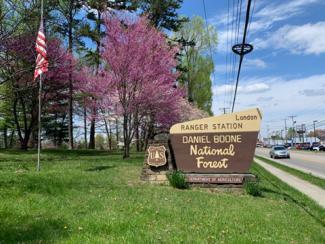
NETL used digital data to guide a search for orphan wells in Kentucky’s Daniel Boone National Forest.
Daniel Boone, James Harrod and George Rogers Clark once explored the wilderness of Kentucky with little more than long rifles and curiosity to find places suitable for new settlements. More than 240 years later, a team of NETL researchers roamed much of the same turf with an array of sophisticated data and equipment to uncover long-abandoned oil and gas wells that could leak methane gas into the atmosphere.
Since the days of Boone, Harrod and Clark, the nation saw big and small industries come and go, mostly powered by oil and natural gas. Much drilling occurred throughout Appalachia to tap needed oil and gas resources. Over the years, many of those wells were abandoned without documentation. Those abandoned wells, known as orphan wells, were drilled long before environmental laws were enacted and many no longer have a responsible operator. Orphan wells can be found all over the country.
Today, many orphan wells are leaking methane gas, a potent greenhouse gas, and finding and capping them remains a priority as the nation works toward a decarbonized atmosphere. When officials with the Kentucky Geologic Survey (KGS) became aware of NETL’s growing success at finding and documenting orphan wells, they reached out for the Lab’s help.
“The KGS was looking for wells in the Daniel Boone National Forest but did not have the equipment or experience to collect methane emissions measurements,” NETL’s Natalie Pekney, Ph.D., explained. “After they reached out to us, we worked out an informal collaboration to help.”
As a result of that agreement, Pekney took her team to the national forest for the first of three visits.
“Our team met up with the KGS, and we started out by using existing state database locations to find wells,” Pekney said. “Many of the coordinates were inaccurate so the wells were extremely hard to find.”
By the time the NETL team planned its second and third trips to the Daniel Boone National Forest, they were using additional digital resources to map out potential well site locations before trekking through the forest. The team’s array of tools included:
Pekney said the digital data sources for project areas allow the team to answer key questions associated with orphan well hunting including:
“Having probable well locations located as accurately as possible before heading out in the field saves time and money by making the final field verification step much more efficient,” she said.
Armed with the array of additional data, the NETL team returned to Kentucky to determine the presence of wells, record high precision coordinates for well locations, and measure methane emissions from the wells that were found.
Two of the 60 wells that were found were leaking measurable quantities of methane.
Pekney said the overall purpose of NETL Daniel Boone National Forest field trips was to demonstrate the effectiveness of layering multiple sources of digital information to facilitate field-based well finding and to increase the sample size of wells from which methane emissions measurements have been collected so that a clearer understanding of emissions distributions for the region could be developed.
Results from the Kentucky work will be included in best practices guidance and shared with state, federal and tribal oil and gas regulatory agencies to aid their efforts to find and remediate orphaned oil and gas wells.
NETL is a U.S. Department of Energy national laboratory that drives innovation and delivers technological solutions for an environmentally sustainable and prosperous energy future. By using its world-class talent and research facilities, NETL is ensuring affordable, abundant, and reliable energy that drives a robust economy and national security, while developing technologies to manage carbon across the full life cycle, enabling environmental sustainability for all Americans.

