BLM and DOE are working together to protect the environment while supporting the goal of increasing domestic oil and gas production. As the primary manager of Federal Lands, BLM has the responsibility to balance the many public uses of the land, including oil and gas production, with environmental protection. Because of the need to protect varying interests, a cumbersome system of stipulations and permitting requirements has evolved that effectively limit oil and gas development. Many of these stipulations, however are based on historical industry practices and do not consider current or new innovative industry capabilities to minimize disturbance, protect the environment, and to minimize aesthetic impacts. Other restrictions result from assumptions about environmental protection standards and/or pollution from oil and gas activities that have never been verified by research. The four tasks of the BLM/DOE interagency agreement are aimed at helping resolve issues that affect access to Federal Lands for oil and gas operations.
Project Results
The 3M study provided validation of field data necessary to design a well monitoring program for the San Juan Basin. The study demonstrated that methane seepage along outcrops will increase with further coalbed methane development in the San Juan Basin. In Seminole County, OK brine leakage from oil field operations dating back to 1900 have been mapped.
The water quality monitoring project in the Powder River Basin established guidelines and methodology for future monitoring of CBM produced water flow and infiltration into the subsurface.
The Sage Grouse study in western WY is a critical issue. Sage grouse populations were evaluated for possible inclusion on the Endangered Species list. Data provided by this project will assist Federal Agencies in making that determination.
Benefits
The studies have provided models, and data critical to support land use decisions for Federal Agencies, County and State planners in four western states (Colorado, New Mexico, Oklahoma and Wyoming). Data gathering and research on CBM, abandoned oilfield sites and animal populations provide valuable scientific evidence on past and potential future effects of oil and gas development on water quality, soil remediation and habitat disturbance. The information is used to inform the public of scientific facts concerning specific topics, which have generated controversy and/or misinformation from private groups or individuals.
Project Summary
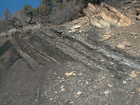
The 3M project in the San Juan Basin has assessed the methane seepage impact related to the closer spacing of Fruitland CBM wells from 320-acre spacing to 160-acre spacing. The research on the potential methane seepage at the outcrop is the first to quantify the seepage rates and tie them to production activities in the basin.
- Fruitland outcrops in the Colorado portion of the San Juan Basin were mapped to define pre-development conditions.
- Four monitoring well clusters were sited and installed to monitor water level changes associated with CBM development.
- The analysis indicates that methane seepage will increase at rates of 4 to 20 times if the proposed well-spacing change was made.
- The reason for this increase methane loss at the surface is the reduction in water pressures within the coalbeds which result from CBM development.
- A hydraulic interconnection between the down-dip producing Fruitland coalbeds and the outcrops has been demonstrated.
- Industry has expressed interest in recovering the methane that is lost to the atmosphere at the outcrop.
- The Environmental Protection Agency (EPA) used data from the project to develop the Environmental Impact Statement (EIS) for the San Juan Basin.
The project in Seminole County, OK investigated the effect of brine leakage from historic oil field sites and the continued affects of aquifer quality. The work performed by the University of Tulsa used Global Positioning Satellite technology to analyze the spatial relationship of water samples to oil and gas fields.
- Data was collected to develop a gradient flow model for aquifers.
- A model was developed to show the distance, depth of penetration and long term effects and/or cleansing of brines passing through soils into aquifers.
- The maps and water probe analysis were used to identify areas for remediation.
The increase in CBM development since the early 1990s has led to public outcry concerning potential effects on water quality. The primary objectives of the monitoring effort were to insure that the completion procedures used on CBM production wells were adequate to minimize inter-aquifer communication and protect the water quality and availability in aquifers adjacent to the methane target aquifers.
- CBM wells in the Powder River Basin were found to yield an average of 10 gallons of water per minute.
- Equipment was designed and installed in four water monitoring wells to test for contaminants, evaluate cement integrity, and evaluate communication between wells.
- The equipment is solar powered to allow minimum maintenance and long-term collection of data.
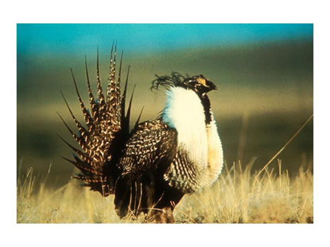
The study of wildlife populations and habitats in western Wyoming concentrated on sage grouse breeding and nesting sites near Pinedale in Jonah Field, a large recently-developed natural gas field.
- The study looked at the size of breeding areas and the impact of oil field activities including noise, lights and human foot and vehicular traffic on sage grouse populations.
- Regulation of the areas by establishing areas to be avoided, seasonal use, reduction of roads and restricted hunting have been shown to benefit sage grouse population numbers.
- BLM is adopting best management practices based on scientific research for managing both wildlife and access to fluid minerals on federal lands
Current Status (August 2004) The majority of the tasks and subtasks in the project have been completed. Final analysis and reports are still in progress for the Sage Grouse study. The sage grouse are currently being evaluated by the U.S. Fish and Wildlife Service (FWS) for possible inclusion on the Endangered Species list. The DOE study results may provide data to show that oil and gas activities have not significantly harmed the species, and that the species does not merit the restrictive protection of Endangered Species status. The Western Governor's Association has requested FWS to hold off its decision until the sage grouse study has been reviewed.


